
Mapping the Enlightenment
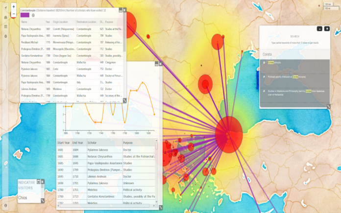
The project uses some of the latest innovations in digital mapping in order to provide user friendly dynamic web maps of the itineraries of traveling scholars, and visually represent the building of networks between scientific and technical centers and peripheries. The project is a dynamic system capable of providing multi-layered maps, which enable users to query and visualise data and flows through a modern and robust environment. This interactive interface shows with a simple and affective way how the intellectual networks developed in the European periphery in the 18th and early 19th centuries contributed to the shaping of knowledge during the Enlightenment.
Website
Partners
University College London
The National Archives (UK)
University of Athens
Project Team
Dr Vassilis Routsis
Dr Eirini Goudarouli
Prof Manolis Patiniotis
Funders
Research Centre for the Humanities (https://www.rchumanities.gr/en/)